Loading

Map of the Caribbean Islands

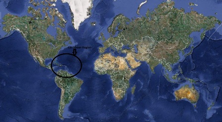
The following map of the Caribbean islands hopefully can help you visualise the location of islands in the Caribbean region.

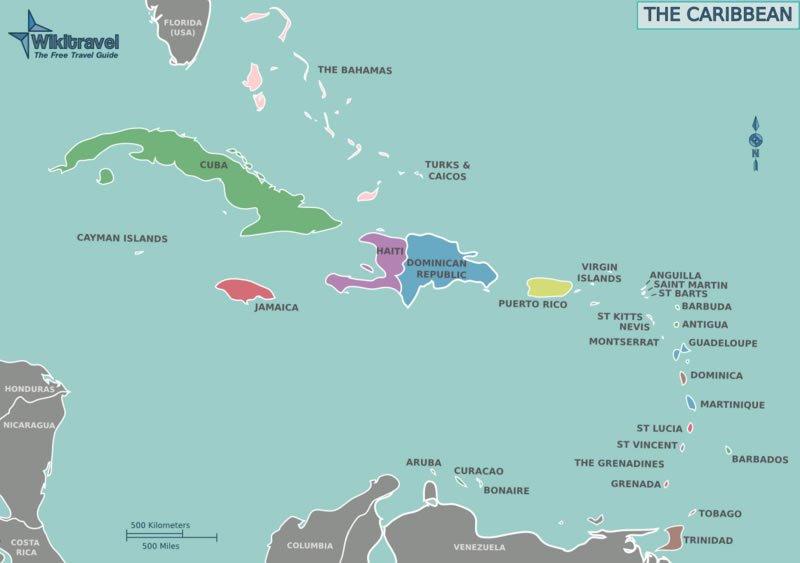
This first image gives you a visual of the Caribbean. Each island is named. Feel free to click on the islands to get more information on each country.

Bahamas Turks & Caicos Cayman Islands Jamaica Haiti Dominican Republic Puerto Rico US Virgin Islands Anguilla St. Maarten/Martin St. Barths Barbuda Antigua St. Kitts & Nevis Montserrat Guadeloupe Dominica Martinique St. Lucia St. Vincent Barbados Grenada Trinidad & Tobago Bonaire Curacao Aruba British Virgin Islands Saba

There are also some great scuba diving vacations among Central American countries. The Caribbean sea also washes upon the shores of these Latin American countries with beautiful dive destinations.

Click on these islands to discover more.

Belize Honduras Guatemala El Salvador Nicaragua Costa Rica Panama

map-of-the-caribbean-islands-01

The following Caribbean map is a closer look at the region. It is really helps you to see where the islands are in relation to each other.

map-of-the-caribbean-islands-02

Here is a very interactive map, you can zoom in or out and
fun with this map of the Caribbean.


View Larger Map

I hope this has been enlightening to you and you are able to choose your next vacation using any map of the Caribbean I have provided.

Return from Map of the Caribbean Islands to Caribbean Scuba Diving Vacations HomePage


Subscribe to
Caribbean SCUBA Lovers

Enter your E-mail Address
Your First Name
Then

Don't worry — your e-mail address is totally secure.
I promise to use it only to send you Caribbean SCUBA Lovers.

joomla stats

Quantcast